­

Our Projects

Our Projects

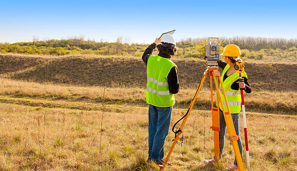
L & K SOLUTIONS Are a leading company In the area of Land and Quantity Survey, Cartography, Geological mapping, Geotechnical investigation and related Study Of Project Sites, We are well equipped with all Modern instruments and technologies, Viz. Programmable total Station electronic theodolite,electronic distance Meters, automatic levels, Remote Sensing, CAD and a large number of application softwares.

LAND SURVEY

Land surveys are being done in every case of sale or purchase of land by individuals and acquisition of land from the public by the Government. The Government also carries out land survey in routine to upgrade its maps and charts.

While buying and selling land it is essential to survey the land so that the exact measurement of the land can be arrived at. Since the rate of sale and purchase is known, it is quantum of land that will be used to arrive at the total price to be paid or received. The same logic applies when Government is acquiring land from the public for some project etc.

TOPOGRAPHY

Topography of a place is its landscape, geography and countryside, or in other words it can be shape of a plot or the features found on it. A surveys company is often asked to carry out Topographical Surveys for clients as they intend to effectively utilise the land for development of a project.

The land could be undulating, uneven and having slope etc in the wrong direction. Often companies do purchase undulating land as it is cheaper that totally developed and levelled land. After Topographical surveys required areas are prepared and made uses of, resulting in substantial saving to the company.

Digital Information Kiosk